
Road Connectivity
Summary
We have made a determina on as to how well-connected the roads network in your neighbourhood is.
Definition
When we refer to road connectivity we are referring to our determination of how well-connected the roads network is. The road network is made up of many links, numerous intersections, and minimal dead-ends (culs-de-sac).
As connectivity increases, travel distances decrease and route options increase, allowing more direct travel between destinations, creating a more accessible and resilient road network system. Well-connected road networks reduce congestion and improve safety. They also reduce daily miles of vehicular travel per household and improve emergency response times.
| Measure | Description |
|---|---|
| Link-Node Ratio | This is a crude measure of connectivity reflecting the ratio of continuous road segments (“links”), to road junctions, roundabouts and dead ends (“nodes”). |
| Walulel Class 1 % | This tells you the percentage of the road network in this postal sector that is best classified as Walulel Class 1 Links. These are streets/roads/paths that can be used for multi-modal transport, but can also be used for retail or leisure purposes such as White Cross Street or Exmouth Market |
| Walulel Class 2 % | This tells you the percentage of the surface mobility network in this postal sector that is best classified as Walulel Class 2 Links. These are streets/roads/paths that are primarily used as cycle paths and/or pedestrian roads/footways and are ordinarily inaccessible to motorised vehicles. |
| Walulel Class 3 % | This Tells you the percentage of the surface mobility network in this postal sector that is best classified as Walulel Class 3 Links. These are streets/roads/paths that are primarily local roads intended for local traffic only (i.e. they are only used by local traffic or local people). These are often known officially as “Unclassified Roads”. |
| Walulel Class 4 % | This tells you the percentage of the surface mobility network in this postal sector that is best classified as Walulel Class 4 Links. These are streets/roads/paths that are primarily smaller roads intended to connect together local roads with main and trunk roads, and often link a housing estate to the rest of the network; (i.e. similar to ‘minor roads’ on an Ordnance Survey map) C roads are known officially as “Classified Unnumbered” |
| Walulel Class 5 % | This tells you the percentage of the surface mobility network in this postal sector that is best classified as Walulel Class 5 Links. These are streets/roads/paths that are primarily major funnel roads intended to connect different areas, and to feed traffic between trunk roads and smaller roads on the network (e.g. Oxford Street). |
| Walulel Class 6 % | This tells you the percentage of the surface mobility network in this postal sector that is best classified as Walulel Class 5 Links. These are streets/roads/paths that are primarily major Trunk roads, often dual lane intended to provide fast large-scale transport links within or between towns/built up areas; (i.e. motorways or main roads). |
| Walulel Node Quality Estimation | This is a score ranging between 1 (lowest and worst) and 3 (highest and best), based on how well connected, on average, the nodes in this postal sector are to the rest of the local mobility network. |
| Custom Walulel Road Connectivity Score | This is an indicative score that lets you know, how far above or below the London wide mean your neighbourhood’s level of road/street connectivity is. We have rescaled the results to ease interpretation so that a score of 50 represents the mean, while a number closer to 100 represents a higher relative level of road/street connectivity, whereas scores closer to 0 represent lower levels of road/street connectivity. |
Why the metric matters from a commercial inhabitant’s perspective
Understanding exactly how well-connected the roadways are in your area of business is useful for discerning exactly how complex logistics will be in your area, particularly if you are in a company that trades large amounts of physical goods. A higher score will indicate much simpler and easier logistical planning, whereas a lower score will require much more complex transportation arrangements.
The connectivity score will also indicate to advertisers and street-facing shopfronts that there is a much more steady and consistent flow of persons through a given area, meaning that there will be a more significant amount of exposure to any static advertising. In contrast to this, a low connectivity score will indicate a lower number of people exposed to advertising. However, the advertising they will be presented with will be for a longer duration, so this will help to understand specifically what kinds of advertising to deploy.
Why the metric matters from a residential inhabitant’s perspective
Road connectivity will indicate to residential inhabitants what kinds of transport flows are present within their area. A higher connectivity rating will indicate a consistent flow, which may suggest business and higher traffic speeds on main roads, and an increased level of active travel. A lower score can indicate higher amounts of congestion and pollution, as well as queues at peak times.
Observing the Walnsight map, if an area has a long main road with a low road connectivity score, this can mean that the area is fragmented by a long busy road that divides the neighbourhood into parts, due to there being a physical barrier to flows of people across this area. This is not always bad, however, as some roads with a large number of shopfronts and street parking can become sites of social interaction and community cohesion. For example, New Cross Road and Lewisham Way in southeast London often transform into social spaces at night-time as communities gather outside of shops.
General commentary
Roads comprise an integral part of the UK’s infrastructure, enabling the flows of people, goods and services within cities and across international boundaries, as well as connecting infrastructures to one another. Described by some as the arteries through which the economy pulses, roads link producers to markets, workers to jobs, students to educational facilities, and the sickly to hospitals. Whilst seldom considered, how humans move across and through roads defines our experience of the world as we travel from place to place, continually engaging with various speeds, rhythms, and temporalities.
For example, being stuck in traffic on a congested road will often induce a sense of frustration and boredom as one becomes aware of the drag of time that could be better spent. Similarly, smoothly gliding across an empty night-time road illuminated by set after set of green traffic lights can create a sense of calm, efficiency, and peace. Roads create and connect boundaries between people and places, and as mentioned in the above passage, can even become spaces of social interaction themselves. The management of road systems in industrialised nations such as the United Kingdom is an increasingly difficult task, as even minor changes, such as the introduction of a one-way system or traffic control measures, can completely transform a neighbourhood area with increased or decreased flows of transport.
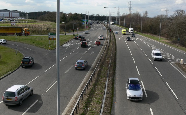
(Photograph: Mat Fascione, Wikimedia Commons)
Trivia
The A1 is the longest classified road in Great Britain, stretching across 396 miles from London to Edinburgh.
History
Road Connectivity Roads in Great Britain have long been popular within the cultural imagination as spaces of freedom. This is largely due to the influence of the automotive industry within American media, which depicts private motor transport along expansive highways as the ultimate symbol of freedom. Journeys along roads are frequently represented as avenues to self-discovery or a better future through travel and exploration, and this has influenced British perceptions of roads and transport since the 1940s.
Public opinion is however far more critical of this representation in the UK, and although roads boomed from the 1960s to the 1980s, resistance grew in the age of Thatcher’s Britain when state-backed private enterprise began to infringe on the daily lives of average citizens. Various local community and environmental movements have since resisted the development of road infrastructure in numerous ways, often on the basis of environmental damage, aesthetic ruination, and community division.